

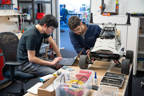

Ken Forster Speaks with Dr. Zhenzhong Su, CEO and Co-Founder of Fixposition, a Swiss startup that provides precise positioning sensor for autonomous robots. Fixposition is Momenta's most recent investment from our Digital Industry Fund.
Ken: Good day, and welcome to episode 161 of Momenta's Digital Thread podcast series. Today, I'm pleased to host Dr. Zhenzhong Su, CEO, and Co-founder of Fixposition, a Swiss startup providing precise positioning for autonomous things. Fixposition is Momenta's most recent investment from our Digital Industry Fund. Zhenzhong received his Ph.D. from ETH Zurich with research focused on precise GNSS/GPS positioning. While there, he won the European Space Agency space innovation prize in the European Satellite Navigation Competition. He was also recently been nominated as a Digital Shaper by Swiss magazine Bilanz in 2019.
Dr. Su: First of all, I want to thank you, Ken, for having me here. It's an honor to be featured in Momenta's Digital Thread Podcast, where many great entrepreneurs have shared their vision and industrial insights. I'm excited to have this conversation with you. We have to cover so many exciting themes, and I look forward to this conversation.
Ken: What would you consider to be your digital thread? In other words, the one or more thematic threads that define your digital industry journey?
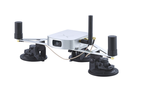
Dr. Su: If the definition of the Digital Thread creates a closed-loop between digital and physical worlds to optimize products, people, processes, and places, which is the core concept of digital transformation in industry 4.0 and smart city. Then I believe I have two Digital Thread: my 10 years of academic life in Geomatics. It's about digitizing the earth the world we are living in: defining, measuring, collecting geospatial information of the planet using both ground-based surveying measuring systems like a theodolite, laser scanners, airborne systems like drones, but also space-based systems like remote sensing satellites, Global navigation satellite system GNSS/GPS; The other big part is about processing and utilizing these the geospatial information for a broad range of applications like establishing and maintain global coordinate systems, creating the mapping, developing positioning and navigations systems by combining the GNSS/GPS and the geospatial information represented by the map. The second digital thread comes from what we do at Fixposition: we provide and develop technology to enable precise global positioning which works everywhere. In other words, our technology can measure, collect, and produce high-precision digital positioning information, which is key for the deployment of autonomous robots and drones. And we believe down the journey. We will discover much larger value and contribute to the world's advance towards a higher level of digitalization and automation.
Ken: You've been studying and working in the science of Geomatics for almost two decades. What attracted you to this space?
Dr. Su: I have to be honest, after my high school exam in China, when I had to fill in what subject I wanted to study for my bachelor's, I didn't know enough about Geomatics. All I knew was that I was very good at mathematics, physics and I liked them. So I decided to take a subject in the natural sciences field and went to Wuhan University to study Geophysics. A big part of that was about Geomatics engineering, back then and still, nowadays, Wuhan University is among the leaders in Asia in this field.
When I got the chance to go to the University of Stuttgart for my master's studies and my Ph.D. research at ETH Zurich, it was driven by my passion and strong interest in how cool it would be to develop a positioning and navigation system to enable autonomous driving.
In geomatics engineering, we had the chance to study all sorts of measuring, positioning, and navigation systems. Exact GNSS positioning was the focus for my Ph.D.
The more you learn about something, the more interesting it becomes. I still remember my professor's quote at ETH Zurich: Albert Einstein would love the Geomatics and geodesy of nowadays, as it is all about time and space.
Ken: What changes have you seen in both the science and application of Geomatics during that time?
Dr. Su: One common trend in both science and application of Geomatics is that the precision and the level of automated data processing has advanced a lot driven by the fast development of new sensing technology, new space technology, computer vision, and artificial intelligence.
What I have seen from ETH Zurich in this field is that the new research topics are about applying machine learning to enable high volume and automated geospatial data processing like large scale crop classification from satellite images; automated 3D point cloud processing; studies on the impact and application of low earth orbit satellites for positioning and remote sensing purpose.
In the application field, it evolves together with the macrotrend of digital transformation and autonomous driving. Digital twins, HD mapping, high precision positioning, and navigation for autonomous driving are all excellent examples for applications of Geomatics. In my most familiar domain, centimeter-accurate GNSS positioning technology: RTK, the real-time kinematic GNSS positioning algorithm, has existed for a long time. In the beginning, it was mainly used for geo-monitoring of structure deformation, mass movements like landslides, surveying for cartography usage, and scientific research purpose. Nowadays, it is widely used by drones, robots, and autonomous vehicles as an essential part of their autonomous navigation system.
There is a clear trend that the borders between Geomatics, computer vision, robotics, and other subjects are disappearing as you find them in each other
Ken: All of this has culminated in your co-founding of Fixposition in 2017. What is your origin story (i.e., what problem did you set out to solve and for whom)?
Dr. Su: In my Ph.D. project, we developed a low-cost centimeter-accurate RTK GNSS positioning system and used it for rockfall and landslide monitoring purposes. In the same period, the rise of autonomous drones, robots, and self-driving cars made the whole world exciting. It didn't take long for me to realize that strong demand for the precise positioning RTK technology can provide to autonomous navigation is coming. I started to work on the first centimeter-accurate RTK GNSS positioning prototype for autonomous drones and vehicles together with Tonio Gesell. We won the European Space Agency prize at the European satellite navigation competition, which encouraged us to present the technology and business idea to ETH Zurich for its pioneer fellowship program (which is a startup incubation program).
In that program, we got the chance to talk to a broader range of drones, robots, autonomous cars, and even train companies. I still remember it was nearly 100 companies we have spoken with. We learned that what is missing to enable large-scale autonomous navigation is not the precision but the availability of precise positioning. Taking GNSS as an example, RTK GNSS can reach centimeter accuracy in open fields. Still, its accuracy will degrade to 10s of meters between high buildings or will not work in tunnels where high precision is most needed for autonomous navigation purposes.
Since GNSS technology will never solve that pain point, we struggled until the exciting moment after talking to Lukas Meier and Lorenz Meier. They were in another pioneer fellowship team working on computer vision for drone navigation and inspection. We realized that by combining RTK GNSS and computer vision, we could increase the availability of precise positioning to where it wasn't possible before. We then incorporated Fixposition and also immediately entered the incubation program of the European Space Agency business incubation center in Switzerland.
Ken: What have been some of your critical use cases and wins?
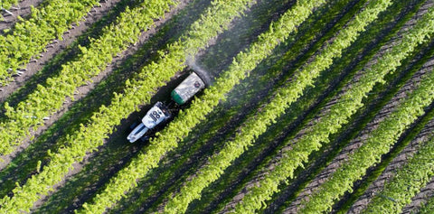
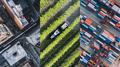
Dr. Su: Currently, we are very much focused on the agricultural, logistics, and industrial robots' market where we believe on one side autonomy will come earlier, and autonomy in these fields will help solve global challenges like food shortage, labor shortage, and green energy transition and on the other side, our technology is in high demand.
For example, our customers Neolix, Pix moving, and Agilex provides autonomous robot platforms and the end solution for exciting and valuable applications like post-delivery, food delivery, and factory patrol and inspection.
We have customers integrated our positioning sensor into their weeding and seeding robots which demand dm or even centimeter-accurate positioning all the time.
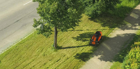
We also have lawnmower robotics customers testing our technology for their following generation product.
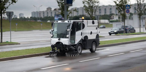
These robots operate in complicated environments where it is difficult to get high precision positioning to maintain autonomous operation—precisely the places where our technology shines.
Ken: Can you outline the different approaches to positions (i.e., RTK, GNSS, video, LIDAR)?
Dr. Su: Currently, GNSS positioning uses the GNSS receiver to measure the signal traveling time and convert it to the distance between the user receiver and the satellites. With four or more GNSS satellites with known positions and measured distances, one can estimate the position of the user receiver. The simplified description will be it's like trilateration if we forget about the need to estimate the receiver clock errors. In the real world, there are many errors like ionospheric delay, tropospheric delay, satellite orbit error, satellite clock errors, and others. We have to either model or estimate to get good positioning accuracy.
As differential GNSS technology, RTK uses a double differential data processing approach to cancel most of the errors mentioned above as they appear as common errors between satellites and between two GNSS receivers. And most important, RTK uses carrier phase measurements which are a hundred times more accurate than the pseudo-range measurements used in standard GNSS positioning. By solving the carrier phase ambiguity, one can get positioning accuracy at the centimeter level.
Camera or visual positioning technology processes the image taken by a camera, tracking feature points or landmarks in consecutive images. In Visual odometry, the displacements of these feature points in adjacent image frames are compared to measure the relative position change of the camera. SLAM (Simultaneous localization and mapping) approach will first create a spatial map of these image feature points, which is then used to localize the camera position in that map by comparing the feature points saved in the map to the ones seen by the camera in real-time.
Apart from Visual SLAM using cameras, also Lidar SLAM can be done using Lidars, where in comparison to the feature points in-camera images, directly a 2d or 3d point cloud of the surrounding environment can be measured by measuring the travel time of an emitted laser beam reflected the Lidar sensor. This measured point cloud can then be matched with a mapped point cloud to determine the position of the Lidar sensor.
Ken: Several companies combine 'sensor fusion techniques to improve positioning accuracy. What makes Fixposition's approach unique?
Dr. Su: The technology we are developing we call it: deep sensor fusion. There are two places we make ourselves unique:
1. Tight coupled sensor fusion algorithm and software. Unlike others combines the output of different sensors, we process the data from GNSS, camera, Inertial measurement units, and additional sensors in the future at the raw measurement through a global optimized estimation approach.
2. We feed these data with different characteristics into our machine learning pipeline to train and learn from the data itself to know in which scenarios we can trust which sensor more.
Via this approach, we can take best the advantage of the fact that the error sources of these different sensors are independent or even exclusive to each other. For example, in between high buildings where the GNSS signal is blocked and reflecting from the surface of the building, generate so-called multipath errors to GNSS signals; GNSS positioning will fail heavily here. However, the camera can capture high-quality feature points from the building structures and performance very well here. So, we can use the excellent vision data to correct the wrong GNSS positioning. And in other scenarios, the other way around.
Another essential difference we are making is that our deep sensor fusion can run on a relatively light-weighted HW platform due to its high computation efficiency.
Ken: Truly, I was interested to see your founding of Fixposition in Zurich. How have you found the Swiss ecosystem for funding startups?
Dr. Su: It was literally by word-of-mouth. In the 3rd year of my Ph.D. at ETH Zurich, I was chatting with a friend I had just made during a break at a football game. His family name is Li. He told me about his ETH Spinoff ZuriMed, which develops innovative surgery suturing technology. After knowing what I was doing for my Ph.D. research and what it can be used for, he told me that it's worth looking into a broader range of its application and the best way to find it out is to make a startup. But I had no clue how to find a startup in Zurich. He then shared all his experience, and most importantly, shared with me the tremendous Swiss ecosystem Switzerland has: VentureLab, ETH Pioneer fellowships, Venture kickers, ESA business incubation center. They provide great supports to startups from different aspects and at different stages.
Ken: Given your entrepreneurial journey, what would you advise other startup founders?
Dr. Su: I am still learning myself. But if I could share something with those thinking about starting a startup, the advice would be: think big to find something you genuinely believe can generate value, and you genuinely enjoy doing it for many years was literally.
Ken: In closing, where do you find your inspiration (think books, people, online, etc.)?
Dr. Su: One of my biggest inspirations is Elon Musk - a man who dreams big and achieves great things.
Ken: Thank you, Dr. Zhenzhong Su, CEO, and Co-founder of Fixposition, a Swiss startup providing precise positioning for autonomous things – it has been a great pleasure.