


The field of surveying and mapping faces a complex challenge: achieving precise positioning in environments where traditional GNSS signals are degraded or completely denied. Dense urban canyons, forest canopies, tunnels, and towering construction sites compromise conventional RTK-GNSS systems, which struggle to maintain the centimeter-level accuracy required by modern surveying. These environments aren’t outliers, but represent everyday reality for surveying and mapping professionals.
Fixposition’s Vision-RTK Pro is changing reliability and usability in the field. By combining computer vision with traditional GNSS and inertial measurement systems, this solution delivers results through extended availability of RTK accuracy. This technology is a move toward broader use cases, improved operational efficiency, and new opportunities for surveyors and mappers.
The Problem: Limitations of RTK GNSS in Real-World Conditions
Centimeter-level positioning from RTK GNSS is often a must to have for surveying and mapping tasks. However, in real-world operations, RTK GNSS faces two major challenges that limit its performance and reliability.
1) GNSS-Degraded or Denied Environments
- Urban Canyons: Urban canyons are city environments where streets are flanked by tall buildings. These conditions are problematic for GNSS signals that bounce off glass and metal surfaces, leading to multipath interference that can result in errors of several meters.
- Construction Sites, Underpasses, Bridges, and Dense Forest Environments: In these environments, signal dropouts are routine, positional drift accumulates quickly, and data quality deteriorates significantly. The consequences of signal loss extend to costly rework, project delays, and safety concerns, as measurements degrade.
2) Connectivity Issues to RTK Correction Services
RTK depends not only on continuous satellite signals but also on a reliable data link to a correction service, either from a local base station or via a network RTK provider. In remote, obstructed, or high-interference environments:
- Cellular or radio connectivity to correction sources may be intermittent or lost entirely.
- Even if GNSS signals are available, a break in correction data flow causes loss of RTK fix and reduced accuracy to the decimeter or meter level.
The Growing Demand
As professionals push operations into more complex, remote, and obstructed environments, there is an urgent need for positioning solutions that can maintain accuracy despite both GNSS signal challenges and unreliable correction service connectivity.
Current Workarounds for Surveying Professionals
When RTK GNSS becomes unreliable, professionals often switch to total stations or robotic total stations. While these instruments can achieve high accuracy without relying on GNSS or correction service connectivity, they come with significant drawbacks:
- Higher equipment cost compared to GNSS rovers.
- Requirement for setting up and maintaining control points.
- More complex workflows and longer setup times.
- Reduced efficiency, especially for larger or more dynamic worksites. These limitations make total stations a less desirable fallback, especially for projects where time and cost efficiency are critical.
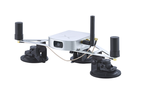
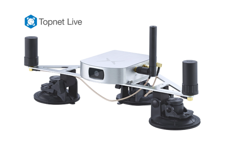
The Fixposition Solution: Vision-RTK Pro
Fixposition’s VIsion-RTK Pro reimagines how precise positioning can be achieved and maintained in any environment. The system combines all-band GNSS receivers, high-grade IMU sensors, and stereo cameras in a unified platform powered by proprietary xFusion software.
The core of this technology lies in the ability of vision-augmented RTK to maintain accuracy during GNSS signal loss. When satellite signals are available, the system operates like a traditional high-performance RTK, delivering centimeter-level precision. When satellite signals are not available, stereo cameras take over, tracking visual features, while algorithms compute precise movement and orientation.
Fixposition’s xFusion deep sensor fusion software automatically assesses all sensor data in real time to always use any data increasing accuracy. Unlike traditional systems where IMU drift accumulates over time, Vision-RTK Pro maintains accuracy within 0.5% to 1% of distance traveled without GNSS. The system’s tilt compensation and embedded antenna design also simplify setup while maintaining consistent performance.
Plug-and-play capabilities also simplify integration across mobile platforms, including drones, backpack systems, and vehicle-mounted rigs. Using the automated sensor calibration and intuitive interface, field crews can focus on survey tasks rather than system management. Standard connectivity options mean the system is compatible with existing equipment and workflows.
Key Benefits for Surveying and Mapping
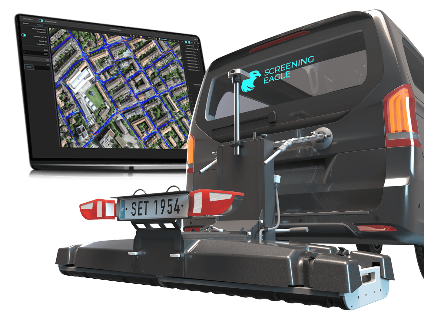
The Vision-RTK 2 integrates with GPR Mapping technology and workflows. | Source: Proceq (A Screening Eagle Company)
Fixposition’s Vision-RTK Pro technology benefits surveying and mapping operations in numerous ways.
- Enhanced Uptime: Uptime is the most significant operational advantage. During field testing in Frankfurt, Germany, the Vision-RTK maintained ±3 cm accuracy between skyscrapers while RTK-only systems drifted by several meters. This level of reliability removes task interruptions and reduces costly delays associated with signal loss.
- Ease of Use: The system addresses persistent complexity challenges in professional surveying. Vision-RTK Pro’s automated sensor fusion requires no manual intervention from operators. Field crews can focus on survey tasks while the system handles positioning automatically. This also reduces training requirements and operational complexity.
- Affordability: Vision-RTK Pro’s integrated design eliminates the need for separate vision systems, specialized IMUs, and redundant GNSS equipment. Importantly, extended operational availability also reduces project delays and costly rework that result from positioning errors in challenging environments.
- Scalability and Integration: The system enables easy adoption across existing workflows, supports standard data formats, and provides connectivity through UART, CAN, Ethernet, and wireless interfaces. This compatibility enables integration with existing stations, data collectors, and mapping software without complete system overhauls. As a result, adoption is straightforward for organizations with established surveying workflows.
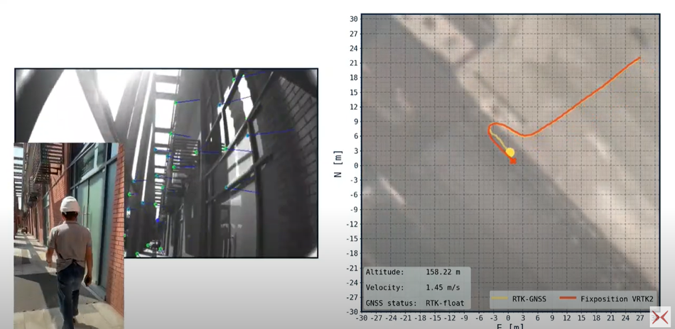
To illustrate the practical impact, consider a hypothetical urban mapping project that requires survey accuracy in areas ranging from open sky conditions to locations under highway overpasses, beside tall buildings and fully indoors. Traditional RTK-only systems would require multiple setups, careful timing to avoid periods of signal loss, and compromise on data quality. Vision-RTK Pro deploying Fixposition’s latest xFusion software enables continuous survey operations across these environments, maintaining accuracy regardless of interruptions in satellite visibility and delivering complete datasets without gaps or degradation. Fixposition’s video demonstrating real-time outdoor & indoor tracking using a helmet-integrated solution illustrates this concept.
Fixposition in the Surveying Ecosystem
Fixposition’s participation in the Esri Startup Program and Esri Partner Community demonstrates the company’s growing momentum within the professional GIS ecosystem. As a first-time exhibitor at the 2025 Esri User Conference in San Diego, the world’s largest GIS conference, Fixposition demonstrated how Vision-RTK Pro technology integrates with ArcGIS applications that surveying professionals rely on.
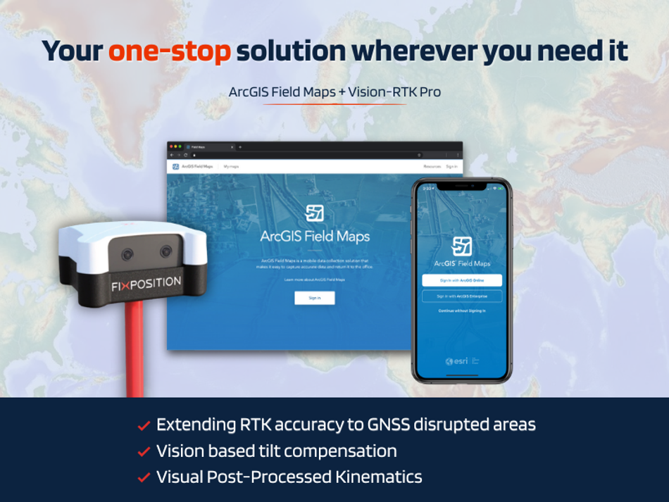
Fixposition’s ecosystem participation enhances value for GIS professionals because it ensures interoperability with existing workflows and tools. Instead of requiring users to adopt new software platforms and data formats, Fixposition’s technology integrates with familiar ArcGIS environments that surveying teams already use for data collection, analysis, and visualization. This compatibility means reduced training requirements and accelerated adoption across organizations that have invested in ArcGIS-based workflows. “Fixposition’s initial integration with ArcGIS provides powerful capabilities for not only field collectors to know their specific location in GNSS degraded environments, but also for others to monitor a fleet of devices streaming positions into a real-time ArcGIS dashboard,” said Jeff Wilson, a senior executive on Esri’s Global Partners & Alliances team.
Alignment with ArcGIS tools supports diverse applications across utility mapping, construction surveying, public safety operations, and environmental monitoring. For utility companies, Vision-RTK Pro enables continuous positioning accuracy, even when working beneath overhead obstructions. Construction teams can benefit from data collection that transitions from outdoor boundaries to covered areas without positioning gaps, while public safety applications may gain reliable positioning for emergency response operations in challenging urban environments.
Future Outlook and Use Cases
Vision-RTK Pro’s capabilities are promising for numerous emerging applications.
- Autonomous Drone Mapping: Equipped with Vision-RTK Pro, drones can navigate complex environments while maintaining precise data collection across mixed satellite visibility.
- Indoor-Outdoor Environments: These mixed environments benefit from positioning that allows for facility mapping transitions without discontinuity.
- Construction Monitoring: Construction applications can leverage consistent accuracy across diverse site conditions to support Building Information Modeling and quality assurance processes.
- Research and Development: Vision-RTK Pro technology opens new possibilities for research and development, particularly in robotics applications that require reliable positioning in difficult environments.12
Fixposition enables surveying professions to work smarter. Instead of planning complex workflows around GNSS limitations or accepting data gaps in challenging environments, professionals can approach projects with the knowledge that their positioning technology will maintain accuracy regardless of conditions.
Conclusion
Fixposition’s Vision-RTK Pro delivers dependable, affordable, and advanced positioning for surveying and mapping applications, even in the most challenging environments. By integrating computer vision with traditional GNSS and inertial technologies, the system provides consistent centimeter-level accuracy in environments that previously defeated conventional positioning systems. The technology is a fundamental shift toward positioning systems that work reliably in every environment that modern surveying demands.
To learn more about Vision-RTK Pro, contact us or request a demo.
About Esri
Esri, the global market leader in geographic information system (GIS) software, location intelligence, and mapping, helps customers unlock the full potential of data to improve operational and business results. Founded in 1969 in Redlands, California, USA, Esri software is deployed in hundreds of thousands of organizations globally, including Fortune 500 companies, government agencies, nonprofit institutions, and universities. Esri has regional offices, international distributors, and partners providing local support in over 100 countries on six continents. With its pioneering commitment to geospatial technology and analytics, Esri engineers the most innovative solutions that leverage a geographic approach to solving some of the world’s most complex problems by placing them in the crucial context of location. Visit us at esri.com.