


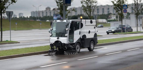


The streets of modern cities are lined with glass and steel, forests close their canopy around remote infrastructure projects, and construction zones sprawl across bridges, tunnels, and high-rise footprints. These are not exceptions but the everyday environments in which surveyors and mapping professionals work
Yet in these very settings, the bedrock of their craft—centimeter-level GNSS accuracy—too often falters. Multipath interference, signal blockage, and interrupted corrections turn trusted workflows into exercises in frustration, with costly rework and lost time as the outcome. For decades, surveyors have managed these gaps with workarounds and compromises. Today, a new solution is emerging that seeks not just to patch the holes but to close them completely: Fixposition’s Vision-RTK Pro, now tightly integrated with Esri’s ArcGIS ecosystem.
The Fragility of RTK in the Field
Real-time kinematic GNSS has long been the standard for precise positioning in surveying and mapping. When the sky is open and correction services flow smoothly, RTK delivers on its promise of centimeter-level accuracy. But in the real world, conditions rarely remain ideal for long.
Urban canyons distort signals through multipath reflections. Bridges, underpasses, and tunnels produce outright outages. Dense forest canopy filters and blocks reception. On construction sites surrounded by heavy machinery and scaffolding, correction links fail as cellular connectivity drops in and out. Even when signals are available, interruptions to correction services can collapse an RTK fix in seconds, degrading accuracy to decimeter or meter levels.
Professionals adapt by deploying total stations or robotic total stations when GNSS fails. These instruments can deliver accuracy but demand more setup, more cost, and more time. They slow dynamic workflows and make continuity difficult, especially on large or complex sites. The result is a persistent accuracy gap between what surveyors need and what RTK alone can reliably provide.
The Fixposition Approach: Vision-Augmented RTK
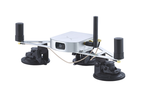
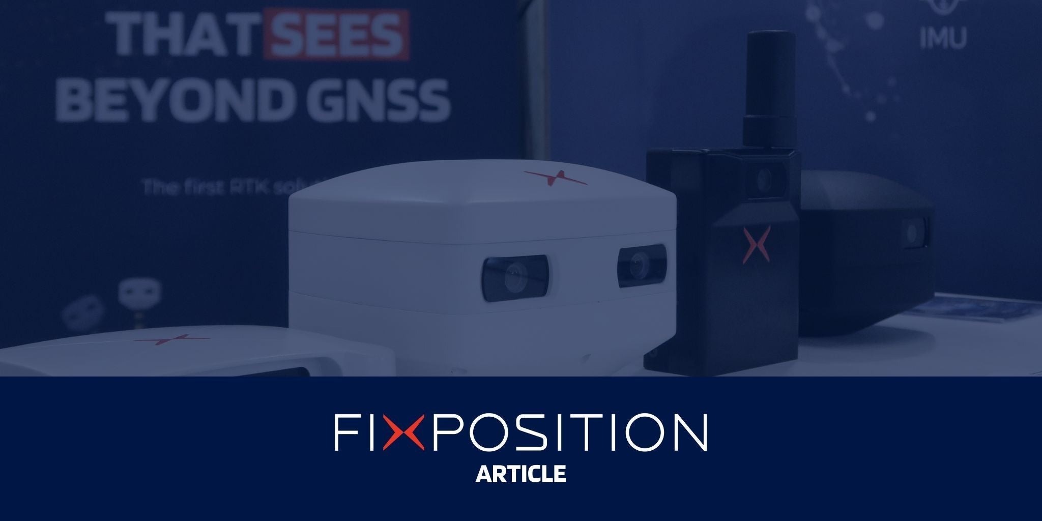
Fixposition’s Vision-RTK Pro was designed to close that gap. The device brings together three critical sensor modalities—all-band GNSS, high-grade inertial measurement, and stereo vision—into a single, compact unit. The key is not the individual components but the company’s proprietary xFusion software, which fuses the sensor data in real time to maintain accuracy even when GNSS is degraded or denied.
In open-sky conditions, Vision-RTK Pro performs like any top-tier RTK receiver, delivering centimeter-level precision. When GNSS signals are obstructed or lost, the system transitions seamlessly to vision-assisted navigation. Stereo cameras identify and track natural visual features while the IMU measures orientation and movement. The xFusion engine continuously blends these inputs, preventing the rapid drift that plagues conventional inertial approaches. By fusing stereo vision and inertial data with algorithms optimized for geospatial applications, Vision-RTK Pro aims to maintain accuracy within about 0.1% of the distance traveled in GNSS-denied environments.
This approach transforms the GNSS “on/off” dichotomy into a smooth continuum of positioning. Instead of collapsing into inaccuracy when signals fade, the Vision-RTK Pro carries positioning forward until corrections return. Surveyors no longer need to halt operations, reset, or revert to slower instruments. The work continues, uninterrupted.

Designed for Surveyors, Built for Integration
Technology succeeds in the field only if it respects the realities of fieldwork. Vision-RTK Pro was designed to minimize friction for surveyors who need precision without complexity.
The system integrates vision tilt compensation and embedded antennas, reducing the need for precise leveling at even bigger tilt angle than the IMU based tilt compensation technology. Automated sensor calibration eliminates manual tuning. Plug-and-play interfaces support rapid deployment across different platforms, from rovers to robots to vehicle rigs. Standard connectivity—wireless, Ethernet, UART, and CAN,—ensures compatibility with existing controllers and collectors.
The result is a solution that fits existing workflows rather than asking professionals to build new ones around the technology. By simplifying setup and operation, Vision-RTK Pro reduces training requirements, cuts onboarding time, and enables crews to focus on the task at hand.
Esri Partnership: From Positioning to Decision-Making
What makes this product more than a hardware advance is its integration with the geospatial industry’s dominant software ecosystem. Fixposition is an Esri Startup Program participant and now a partner in the Esri community. Its technology has been built to align with ArcGIS workflows that tens of thousands of professionals already rely upon.

In practice, this means Vision-RTK Pro can feed continuous, reliable positioning data directly into ArcGIS Field Maps and ArcGIS Dashboards. A utility company can monitor the exact positions of multiple crews in real time. A construction manager can oversee progress across open and obstructed spaces without worrying about data gaps. Emergency response teams can track personnel across challenging urban environments with confidence.
The integration ensures not only that positioning accuracy is maintained but that the data flows seamlessly into analysis and decision-making environments. Instead of exporting, reformatting, or stitching together datasets, surveyors and GIS professionals can stay within familiar Esri tools. The result is faster adoption, reduced training overhead, and immediate operational impact. This kind of integration also illustrates the broader principle of the geospatial ecosystem: innovators like Fixposition extend core platforms, while Esri provides the environment that makes interoperability possible. It is a collaborative model where each partner reinforces the other’s strengths.
Surveying Without Gaps
The value of this approach comes to life in scenarios that professionals face every day.
In urban utility mapping, crews must often work beneath overhead lines, near tall buildings, and under overpasses. Traditional RTK would force pauses and resets, or demand supplemental total station setups. Vision-RTK Pro allows the work to continue, capturing continuous datasets without positional discontinuities.
On construction sites, surveyors are asked to move between outdoor boundaries and interior spaces, documenting progress for BIM and quality assurance workflows. Without vision-augmented RTK, this requires multiple instruments and compromises in accuracy. With Vision-RTK Pro, data flows seamlessly across environments, eliminating the blind spots that slow construction verification.
Public safety operations present another challenge. In disaster response, emergency crews navigate urban zones where GNSS is inconsistent at best. Vision-RTK Pro provides reliable tracking that can be streamed into Esri dashboards, giving commanders a live view of teams in the field. The same applies to environmental monitoring in rugged, forested terrain, where continuity is critical to accurate datasets.
Each case highlights a central theme: workflows no longer have to be designed around the limitations of GNSS. Instead, positioning technology adapts to the environment, not the other way around. This continuity of accuracy is not only valuable for immediate field tasks—it also ensures that the data feeding into larger geospatial systems, such as digital twins, remains reliable and complete. In an era when twins must be maintained as living, evolving systems, uninterrupted positioning becomes a prerequisite.
Reducing Risk, Increasing Uptime
Reliability is not just a technical advantage but an economic one. Every pause in fieldwork, every reset, every rework adds cost. In industries where schedules are tight and margins narrow, those costs are significant.
Vision-RTK Pro addresses this directly by increasing uptime. When operations can continue without interruption, projects finish faster and with fewer errors. Rework is reduced, which means fewer wasted labor hours and less duplicate data collection. The affordability of Vision-RTK Pro, which integrates what would otherwise require multiple systems, amplifies the return on investment.
Compared to robotic total stations, the cost is lower and the workflows simpler. Compared to GNSS-only systems, the continuity is higher and the risks lower. This combination makes Vision-RTK Pro a pragmatic choice for organizations balancing budgets and demanding results. At a broader level, reliability in the field builds trust in workflows. That trust scales upward: the confidence that crews have in uninterrupted positioning becomes the same confidence organizations require in their geospatial infrastructure. Reliable tools at the edge are the building blocks of reliable systems at scale.
Beyond Surveying: A Path Toward Autonomy
While the immediate impact of Vision-RTK Pro lies in surveying and GIS workflows, its implications reach further. Autonomous drones, ground robots, and mixed indoor–outdoor platforms all struggle with the same GNSS challenges that surveyors face. Sensor fusion technology that maintains centimeter-level accuracy through signal loss is foundational for autonomy.

By demonstrating reliable performance in professional surveying—a field with zero tolerance for error—Fixposition positions itself at the forefront of autonomy-ready positioning. Research institutions, robotics developers, and industrial innovators can build on this foundation with confidence that the technology will hold up in real-world deployments.
A Reliability Revolution
The geospatial industry has lived with the limitations of GNSS for decades. Professionals have learned to work around them, but at a cost. With Vision-RTK Pro, those compromises are no longer necessary.
By combining GNSS, IMU, and vision in a single unit powered by xFusion, Fixposition delivers uninterrupted centimeter-level accuracy across environments where GNSS alone has always failed. By integrating with Esri, the system ensures that this reliability translates directly into workflows, decisions, and outcomes.
In an industry defined by precision, Fixposition offers something more: confidence. Confidence that the tools will work where the work is done. Confidence that data will be reliable, continuous, and trusted. And confidence that the next era of surveying and mapping will be built on resilience, not compromise.
This article was originally published on XYHT.
Want to learn more about Vision-RTK Pro? Contact us or Request a Demo.