









Two different failures, routinely confused, with very different consequences
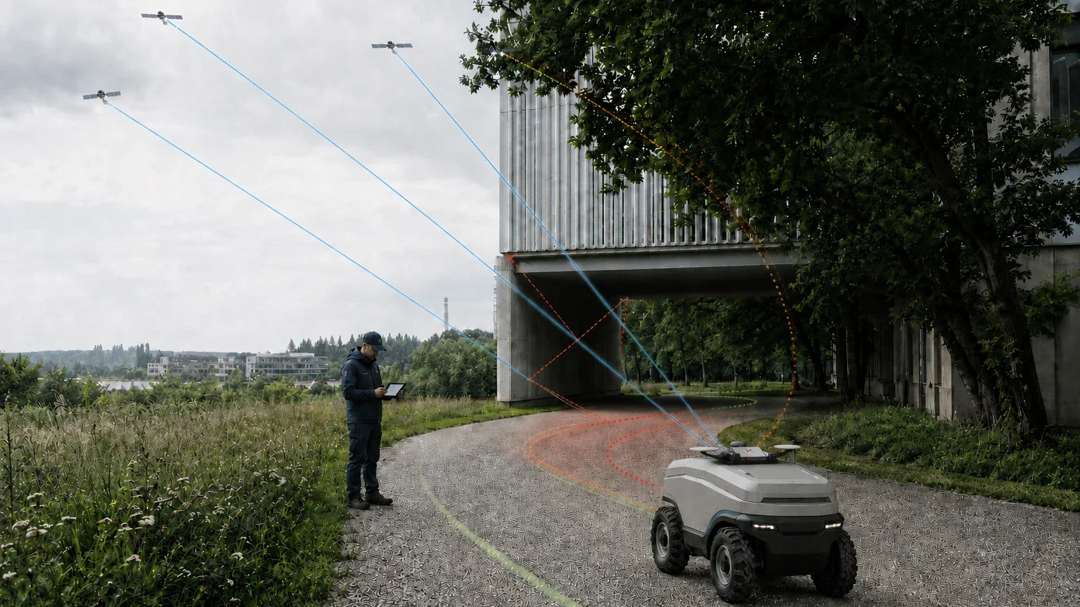
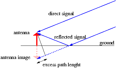
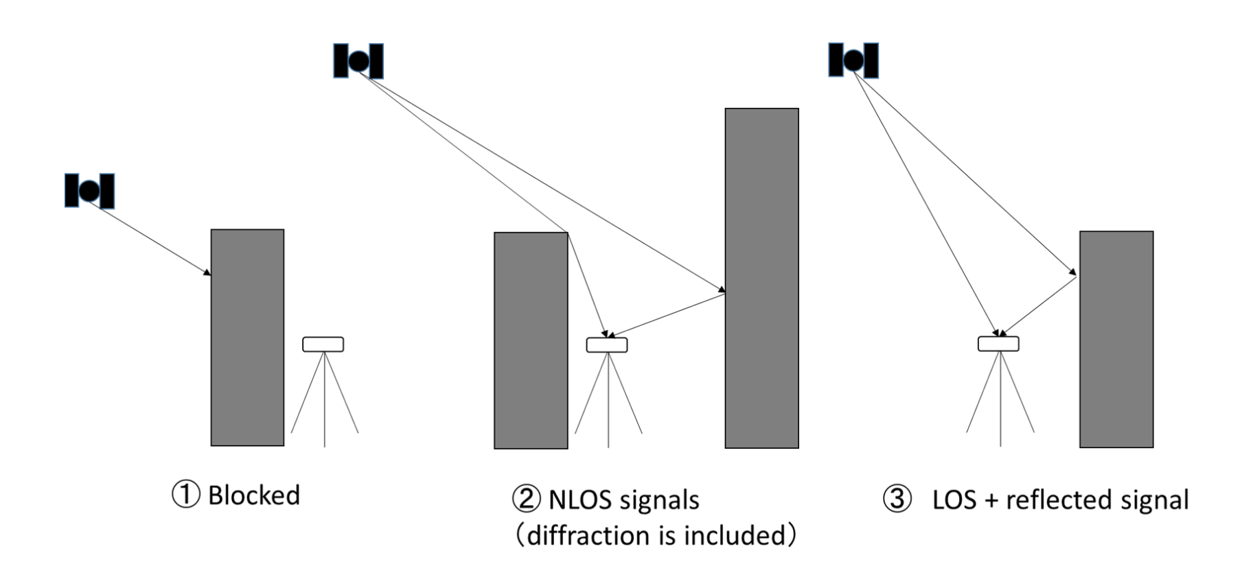
Multipath is when the receiver tracks a direct signal and one or more reflections of it at the same time; they interfere, and the measurement becomes noisy. NLOS is when the direct path is blocked and only a reflection arrives; the measured range is then longer than the true range by the extra path travelled, and nothing in the signal reveals the error. Multipath adds noise. NLOS adds bias — which is far more dangerous, because a biased solution can still be reported as a valid fix.
How large are the errors
The extra distance a reflected signal travels sets the size of the range error, and in a dense city that path can be substantial — a signal bouncing off a facade across a wide street has travelled meaningfully further than the direct path would have. Errors of this kind do not average out, because the reflecting geometry persists for as long as the robot is in that street.
Two consequences matter for anyone building a robot:
- The position can be wrong while the status flag says it is right. If corrupted measurements are consistent enough, the engine may resolve an incorrect set of integer ambiguities and report a confident fix at the wrong place.
- Vertical degrades first. Blocked sky means the remaining satellites cluster in a narrow strip, and the height channel suffers before the horizontal does.
Short multipath and long multipath
Fixposition's documentation makes a further distinction that is useful when reading logs. Short multipath comes from structures within a few metres of the antenna — the robot's own mast, a sensor arch, a nearby vehicle. The errors are small, hard to detect and change constantly as the platform moves. Long multipath comes from distant surfaces; the signals are weaker and easier to detect, but one that slips through undetected can degrade the position badly. Material matters as well: metal, glass and ceramic reflect most strongly, wood and PVC substantially.
The mitigation techniques, and what each is worth
| Technique | What it addresses | Limitation |
|---|---|---|
| Choke-ring or ground-plane antenna | Rejects signals arriving from below the horizon | Bulky, costly; does nothing about reflections arriving from above the horizon off tall buildings |
| Elevation masking | Discards grazing signals most likely to be reflected | Also discards satellites you need when sky view is already narrow |
| Signal-quality weighting | Downweights measurements with poor C/N0 or inconsistent phase | A strong NLOS signal can look perfectly healthy |
| Dual-antenna configurations | Gives true heading and some cross-checking | Both antennas share the same obstructed sky |
| 3D map-aided GNSS | Predicts which satellites are blocked using a building model | Requires an accurate, current 3D city model and the compute to use it; largely an academic field with no established commercial product |
| Fusion with non-GNSS sensors | Provides an independent measurement that contradicts a bad fix | Requires a properly calibrated multi-sensor system |
Why mitigation is not a solution for a moving robot
Every technique above is a way of getting less wrong information into the solution. None of them creates the information that the buildings removed. A surveyor can wait, re-occupy a point, or move two metres and try again. A robot on a delivery route or a mowing pattern cannot: it must produce a trustworthy pose continuously — Vision-RTK 2's fused output is configurable from 1 to 100 Hz — while travelling through the exact geometry that causes the problem.
That is why the credible answer in dense environments is an independent source of motion information. A camera observes the physical world directly, so a reflected satellite signal cannot mislead it. When vision, inertial and GNSS measurements are fused in a single estimator, an NLOS-corrupted range is inconsistent with what the other sensors report and can be downweighted rather than trusted.
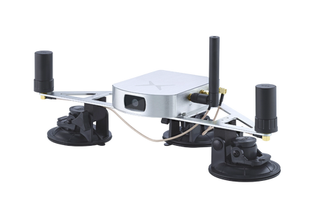
Fixposition's technical documentation on GNSS multipath, urban canyons and NLOS goes deeper into the measurement-level detail, and the Vision-RTK 2 product page covers how the xFusion engine combines the sensors in practice.
Frequently asked
Does RTK fix multipath?
No. RTK removes atmospheric and orbital errors that the base and rover share. Multipath is local to the rover antenna and is not common to both, so corrections cannot cancel it.
Is multipath worse with a longer baseline?
Multipath itself is unaffected by baseline length — it is a local effect. Long baselines add their own errors on top.
Can I detect NLOS in my logs?
Sometimes. Residuals that are large and persistent for particular satellites, position steps when a satellite is acquired or lost, and disagreement between GNSS and odometry are all indicators. There is no single flag that reports it.
Positioning that is not fooled by a reflection. See how Vision-RTK 2 fuses vision, inertial and GNSS to hold accuracy in dense urban environments.


