


The global anchor for digital twin and physical AI

Surveying and mapping are building the digital foundation for Physical AI — a market that reaches far beyond their traditional base in geomatics, construction and machine control. Fixposition provides the global anchor, everywhere, that makes this foundation scalable.
Industry Challenge

A vast majority of geospatial work happens where GNSS signals are degraded, blocked or denied.

Surveying and mapping professionals lose time and accuracy the moment they move into complex environments — under tree canopy, beside buildings, inside construction sites, or indoors. Today that often means switching from an RTK receiver to a total station, re-occupying points, and reworking data. At the same time, commercial pressure keeps rising: deliver faster, with fewer people, without compromising quality. Fixposition is a one-stop positioning technology that closes this gap — extending reliable, survey-grade accuracy into GNSS-disrupted areas so professionals keep one workflow from open sky to obstruction.

Our solution
Surveying and mapping in GNSS-denied environments

10X

10
Better performance than high-end RTK INS  system
Under typical GNSS denied scenarios.

10X

10
Unmatched performance-to-price ratio
Under typical GNSS denied scenarios.

100%

100
Availability even in GNSS denied or restricted areas
Under typical GNSS denied scenarios.
customer success story

Vision AI enhanced RTK: positioning beyond GNSS

Learn more about Fixposition & Topcon
“Customers are increasingly working in environments where satellite connection can be challenging, such as dense urban environments, and need consistent, reliable positioning to maintain productivity. Fixposition offers technology that augments satellite positioning, beneficial for users even while working inside structures and in indoor-outdoor transitions, without disrupting workflows by combining RTK GNSS with artificial intelligence to ensure position accuracy. We see this AI-enabled technology as an innovative integration with our next-generation GNSS solutions.”
Ron Oberlander
Head of the Topcon Geomatics Platform
TRUSTED BY WORLD-LEADING TECH COMPANIES
Built into your instrument

Precise global POSE estimation everywhere.
Two ways to integrate.

License the xFusion software on your own hardware, or drop in our system-on-module. Both deliver survey-grade accuracy where GNSS alone cannot reach.

Fixposition xFusion software

Software

  • Licensing for high-volume OEMs
  • Feature-based subscriptions
Fixposition system-on-module

System-on-Module

  • Low footprint, full feature solution
  • Simplifying integration for OEMs

Features that improve surveying and mapping workflow:

  • xRTK: maintaining accuracy in GNSS-challenged environments
  • xStart & xTilt: instant initialization and tilt compensation at any angle
  • Visual PPK for improved accuracy for longer distance of GNSS outage via post-processing
  • Perceptive Localization: measuring objects in 3D using AI detection
TALK TO OUR OEM TEAM

How Vision and AI redefine the power of RTK

More Industry solutions

EXPLORE OUR FEATURED INDUSTRIES

Tracking accurate 3D position, velocity, and orientation in a diversity of challenging outdoor- and GNSS-denied environments.

Landscaping

Efficient landscaping with more uniform results
Learn more

Utility Robots

Improved speed and autonomy
Learn more

Agriculture

Redefining precision and efficiency in ag-tech
Learn more

Request your Starter Kit now

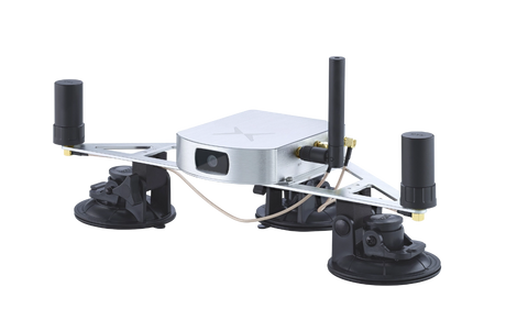
  • Plug and play solution: Fully configured and calibrated to start evaluation immediately
  • All inclusive: Includes antennas, cables ,and batteries needed for full operation
  • Open source ROS 1/ROS 2 drivers for easy integration and adaption to your system